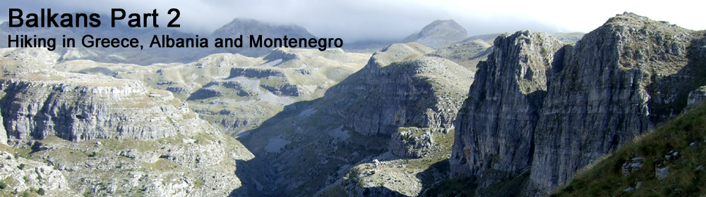
After completing my Via Dinarica adventure in June 2015, I decided it was time to sample some more Balkan delights. So "Balkans Part 2" started off in Northern Greece, crossed into Albania, and finished up in Montenegro.
I flew to Thessalonki on 18th September, then made my way by bus, train and taxi to Summit Zero Hostel at the base of Mount Olympus.
My first target was Mount Olympus, which I climbed on Saturday 19th September. Then the following day I caught a bus to Ioannina, and another bus which chucked me out at the ghost town Kalpaki just as it was getting dark, and an almighty thunderstorm was brewing.
After surviving a terrifying night in tent, I hiked northwards for 5 days through the wild and rugged Pindos mountains to reach Albania via Mount Gramos.
Once in Albania I had planned to head to Mount Korab (highpoint of Albania and Macedonia), but the weather had been so poor the past few days, I didn't fancy another soggy night in the tent, plus dodging the snarling sheepdogs was getting a bit wearing, so I made an end-to-end dash across Albania by bus, from Erseke to Shkodra.
I then spent a few days at the beach before heading to the tourist hotspot of Kotor. This uniquely fortified town looks just like a film set from The Three Musketeers. From Kotor, I made a 5-hour jog up and down Lovćen / Štirovnik 1749m, in the scorching heat.
My final destination was Podgorica, the capital city of Montenegro, where I saw a few thousand protesters lined up against riot police, on an otherwise quiet and uneventful Sunday morning.
Mount Olympus, 2918m
19th September 2015
After spending a fun evening chatting with Markus "with a K" (German) and Joel from Finland, I managed to persuade a young Israeli couple staying at Summit Zero Hostel to give me a lift to the Gortsia trailhead the following morning, which cut out 21km of tarmac, and 1100m of climbing.
So it was around 8am that I started up the trail, knowing I had a good 1800m+ of climbing just to reach the summit. The going was all pretty straightforward until the final 400 metres where it suddenly got steeper and more scrambly. The main hazard being that there were far too many people on the hill, and it was quite tricky to pass safely at speed. I reached the summit in just under 3 and a half hours.
I retraced my steps, then continued down a steep loose path to Refuge A (Spilios Agapitos), at which point I realised I was starting to feel a bit wrecked.
A couple of other runners went by me on the steep descent to Prionia, so I tried to use them as pacemakers to keep me going. It was slightly embarrassing to be greeted at Prionia with cheers and cowbells from supporters of the Lost Trail 56km race which happened to be on the same day. Anyhow, the support crew were super-friendly and gave me cups of Coke, and water with salts, and some snacks from the race refreshments table.
I definitely needed this to get me through the next tough 11km section to Litochoro. On the map it looked like a nice easy downhill traily jog, but the reality was more gruelling, with steep flights of steps and plenty of re-ascents, especially towards the end.
I decided to drop down to the river valley for the final section into Litochoro, rather than down the road, and was again surprised to turn the corner and realise I was at the finish banner of the Lost Trail 56km, with cheers and clapping. I had to stop and walk around the finishing arch to make clear I wasn't in the race.
I sat down at Litochoro for a few minutes, drank a bottle of water, then thought I'd better start moving before I seized up altogether, and knowing I still had another 8km to go. At first I started walking, then jogging, then proper running the rest of the way back to Summit Zero Hostel down at sea level.
Total time on feet about 9 hours. Distance around 41km. Ascent 2200m. Descent 3300m.
After spending a fun evening chatting with Markus "with a K" (German) and Joel from Finland, I managed to persuade a young Israeli couple staying at Summit Zero Hostel to give me a lift to the Gortsia trailhead the following morning, which cut out 21km of tarmac, and 1100m of climbing.
So it was around 8am that I started up the trail, knowing I had a good 1800m+ of climbing just to reach the summit. The going was all pretty straightforward until the final 400 metres where it suddenly got steeper and more scrambly. The main hazard being that there were far too many people on the hill, and it was quite tricky to pass safely at speed. I reached the summit in just under 3 and a half hours.
 |
| On the way up Mount Olympus |
 |
| Looking up the final steep section of Mytikas |
 |
| Summit of Mount Olympus 2918m |
 |
| Looking back to Mytikas - summit of Mount Olympus |
A couple of other runners went by me on the steep descent to Prionia, so I tried to use them as pacemakers to keep me going. It was slightly embarrassing to be greeted at Prionia with cheers and cowbells from supporters of the Lost Trail 56km race which happened to be on the same day. Anyhow, the support crew were super-friendly and gave me cups of Coke, and water with salts, and some snacks from the race refreshments table.
I definitely needed this to get me through the next tough 11km section to Litochoro. On the map it looked like a nice easy downhill traily jog, but the reality was more gruelling, with steep flights of steps and plenty of re-ascents, especially towards the end.
 |
| Greenery below Prionia |
I sat down at Litochoro for a few minutes, drank a bottle of water, then thought I'd better start moving before I seized up altogether, and knowing I still had another 8km to go. At first I started walking, then jogging, then proper running the rest of the way back to Summit Zero Hostel down at sea level.
Total time on feet about 9 hours. Distance around 41km. Ascent 2200m. Descent 3300m.
 |
| Slightly wrecked at Summit Zero Hostel |
 |
| Route viewed in Google Earth |
Pindos Day 1 - Kalpaki to Vradeto via Vikos Gorge
21st September 2015
The day after Mount Olympus, I caught the bus from Litochoro to Thessaloniki, then another bus to Ioannina, and then a late evening bus that chucked me out at the desolate town of Kalpaki. It was getting dark, and there was nowhere to stay, so I hiked up a small hill to an imposing war memorial, which commemorates a major victory for the Greeks over the Italians in November 1940. The Italians had already invaded Albania in April 1939, and thought they could simply march into Greece, but got more than they bargained for. The outnumbered Greek army drove the Italians back into Albania in what constituted the first major land victory for the Allies.
Anyhow, I thought at least up here by this massive threatening statue, no dogs or people would bother me.
What I hadn't bargained for was what the weather was about to throw at me.
I got the tent up, but couldn't sleep for the high humidity, and rumbling thunder across on the Albanian hills. Then with very little warning all hell broke loose. The wind was slamming my tent with gusts so violently I had to cling onto the tent from the inside. Thunder was crashing on all sides. Lightning was filling the sky. The heavens opened. Suddenly I was at the centre of a vortex of cataclysmic rain, wind, thunder and lightning all going off at once. My natural instinct was to pack the tent down and run for cover, but there was no cover to run to, and I would be soaked to the skin if I left the tent.
So there was nothing to do, other than to lie there, clinging onto the tent, feeling completely at the mercy of the elements as the storm raged all around me.
Time has no meaning in these situations. It is just a question waiting it out, and hoping to get through the next few minutes. Eventually the storm must have worn itself out, as I found myself dozing off.
As soon as it was half-light, I was ready to leave and start my 5-day hike to Albania.
My route to reach the Vikos Gorge was a bit of a cross-country thrash.
It started with hiking up a grim road in low light, patrolled by snarling farm dogs. I clutched handfuls of rocks ready to take action if needed. But the ferocious barking dogs always turned away resigned disinterest once you got closer.
After 2 hours I reached the small semi-abandoned village of Elafotopos. I was lucky to find a guy who could fill my water bottle. There were no shops.
I then crossed some high ground before a steep descent to Vikos where I stopped for some lunch, before dropping down into the famous Vikos Gorge where for 14km there's no escape due to the 900m walls on either side.
I stopped at Kapesovo briefly, just for a bottle of Coke, before continuing up some steep stone steps to the next semi-deserted village of Vradeto which I reached just as the rain came on.
I spent the evening at the Hotel in Vradeto chatting with an Israeli couple over a few beers.
The day after Mount Olympus, I caught the bus from Litochoro to Thessaloniki, then another bus to Ioannina, and then a late evening bus that chucked me out at the desolate town of Kalpaki. It was getting dark, and there was nowhere to stay, so I hiked up a small hill to an imposing war memorial, which commemorates a major victory for the Greeks over the Italians in November 1940. The Italians had already invaded Albania in April 1939, and thought they could simply march into Greece, but got more than they bargained for. The outnumbered Greek army drove the Italians back into Albania in what constituted the first major land victory for the Allies.
Anyhow, I thought at least up here by this massive threatening statue, no dogs or people would bother me.
 |
| War memorial |
I got the tent up, but couldn't sleep for the high humidity, and rumbling thunder across on the Albanian hills. Then with very little warning all hell broke loose. The wind was slamming my tent with gusts so violently I had to cling onto the tent from the inside. Thunder was crashing on all sides. Lightning was filling the sky. The heavens opened. Suddenly I was at the centre of a vortex of cataclysmic rain, wind, thunder and lightning all going off at once. My natural instinct was to pack the tent down and run for cover, but there was no cover to run to, and I would be soaked to the skin if I left the tent.
So there was nothing to do, other than to lie there, clinging onto the tent, feeling completely at the mercy of the elements as the storm raged all around me.
Time has no meaning in these situations. It is just a question waiting it out, and hoping to get through the next few minutes. Eventually the storm must have worn itself out, as I found myself dozing off.
As soon as it was half-light, I was ready to leave and start my 5-day hike to Albania.
 |
| The following morning, and pleased to have survived the night |
It started with hiking up a grim road in low light, patrolled by snarling farm dogs. I clutched handfuls of rocks ready to take action if needed. But the ferocious barking dogs always turned away resigned disinterest once you got closer.
After 2 hours I reached the small semi-abandoned village of Elafotopos. I was lucky to find a guy who could fill my water bottle. There were no shops.
 |
| Deserted village of Elafotopos |
 |
| About to enter the Vikos Gorge |
 |
| The Vikos Gorge - no escape for 14km |
 |
| Trail at the bottom of the gorge |
 |
| 900m high side walls of Vikos Gorge |
 |
| Woodland flowers |
 |
| Arriving at Kapesovo |
I spent the evening at the Hotel in Vradeto chatting with an Israeli couple over a few beers.
 |
| Hotel at Vradeto (Balkoni Zagoriou Guesthouse) |
Pindos Day 2 - Vradeto to Vrysochori via Karteros Pass
22nd September 2015
Breakfast at the Hotel at Vradeto, then a long challenging hike through some genuinely wild and remote wilderness.
I started off with a bit of a faffy detour to find the overlook to the Vikos Gorge. It has to be said, the overlook was impressive, and vertigo-inducing even for someone who's not concerned by heights.
After the overlook, some bushwhacking was needed to regain a proper trail, which went over a small hill and then dropped back into a gorge. Most of the trail for the next few hours was pretty indistinct or non-existent, so it was more a question of following the pre-loaded track on my Garmin eTrex 20, and battering through the rocks and grass.
There was a pretty impressive notch at Karteros Pass 2325m, at which point the landscape changed dramatically to steep boulder fields with cliffs towering above, on the northern side.
The going was pretty slow for a while, with a complex descent, until eventually the route joined a better trail contouring through the forest.
The weather did its usual pouring with rain in the middle of the afternoon thing. But the rain had more or less petered out when I reached the semi-deserted village of Vrysochori.
After a bit of hunting, I found the one and only guesthouse. The only other guests were an Israeli couple, and the guesthouse served no food.
Breakfast at the Hotel at Vradeto, then a long challenging hike through some genuinely wild and remote wilderness.
I started off with a bit of a faffy detour to find the overlook to the Vikos Gorge. It has to be said, the overlook was impressive, and vertigo-inducing even for someone who's not concerned by heights.
 |
| Vikos Gorge, early morning |
 |
| Lake District style summit, looking back to Vikos Gorge |
 |
| Dramatic jumbly landscape leading towards Tymfi |
 |
| Narrow contouring path |
There was a pretty impressive notch at Karteros Pass 2325m, at which point the landscape changed dramatically to steep boulder fields with cliffs towering above, on the northern side.
 |
| Karteros Pass from the south |
 |
| Looking down through Karteros Pass |
 |
| Looking back up to Karteros Pass from the north side |
 |
| Karteros mountain |
 |
| Herd of chamois |
 |
| Wild flower |
 |
| Down in the pine forest |
 |
| Approaching Vrysochori |
 |
| Vrysochori Tsumanis Guesthouse www.tsumanis.gr |
Pindos Day 3 - Smolikas from Vrysochori
23rd September 2015
Track on Strava
I knew today was going to be a long hike, so I asked for breakfast at 6am, and was away by 6:40am, getting distracted at the last minute and nearly leaving my wallet behind.
It was still cold, dark and damp as I left Vrysochori and braced myself for 12km of tarmac road marching to Paleoseli.
So after about 2 and a half hours of road walking with stunning views, I reached the small village of Palioseli. There was no shop as such, but there was a small bar/cafe that was open, so I stopped for a drink and bought some chocolate and a small packet of biscuits.
It wasn't terribly obvious how to find the trail to Smolikas from Palioseli, so I eventually found the right trail thanks to some locals allowing me a shortcut through their gardens, and pointing me in the right direction.
Next came 10km of forest trail that climbed higher onto broad ridges leading towards Smolikas.
Just as I reached Drakolimni Lake 2150m the mist came in, and wind picked, which added a sense of urgency. I hid my rucksack behind a scrubby tree, and made it to the summit in about half an hour, and back down in 20 minutes.
Eventually I was running out of daylight, so stopped and put the tent up on this flat dry area under some beech trees.
I'm not sure what the Ray Mears Book of Survival says about camping under trees, but I didn't have too many other options available. I was slightly concerned that if there was another massive thunderstorm, camping on top of hill under some trees might not be the best idea.
I see lightning flickering away on the hills in Albania, and could hear rumbles of thunder. I could also hear all sorts of noises in the woods around me that were making me feel edgy, so I put in my earplugs and tried to get some sleep.
Track on Strava
I knew today was going to be a long hike, so I asked for breakfast at 6am, and was away by 6:40am, getting distracted at the last minute and nearly leaving my wallet behind.
It was still cold, dark and damp as I left Vrysochori and braced myself for 12km of tarmac road marching to Paleoseli.
 |
| Early morning view north towards Smolikas |
 |
| Looking back south towards Tsouka Rosa and Gamila Peak (Tymfi) |
 |
| Looking east up the Aoos Valley |
 |
| Tymfi Mountain and cloud inversion |
 |
| Palioseli |
 |
| Trail through Palioseli |
 |
| Wild bell flowers |
 |
| Broad ridge leading towards Smolikas 2637m |
 |
| Summit of Smolikas 2637m - 2nd highest mountain in Greece |
Just as I got back to my rucksack, the afternoon rain started.
 |
| Drakolimni Lake 2150m |
The descent was around 9km of easy angled forest trail leading down to Agia Praskevi. This looked like a ghost town, and it was still early afternoon, so I decided to just keep on going and camp somewhere in the wilderness before Dhrosopighi.
After crossing the footbridge below Agia Praskevi, the trail suddenly became almost non-existent.
 |
| Wild fruit trees near Agia Praskevi |
 |
| Footbridge near Agia Praskevi |
So the next few hours were slow going, and involved getting swarmed by flies, thrashing through undergrowth, and repeatedly losing sight of any markings. I needed to keep moving to get out of the rough forest to find some water, to find somewhere to camp, and to get my bearings for tomorrow.
 |
| Dusk - looking west towards Albania |
Luckily I found this free-flowing water source just before it got dark.
 |
| Water source |
 |
| Camping below beech trees |
I see lightning flickering away on the hills in Albania, and could hear rumbles of thunder. I could also hear all sorts of noises in the woods around me that were making me feel edgy, so I put in my earplugs and tried to get some sleep.
Pindos Day 4 - Woods above Drosopigi to Aetomilitsa
24th September 2015
I didn't get much sleep camping in the woods, but was pleased to survive the night without any major thunderstorm. I took the tent down at first light, and was away by 7:30am.
I dropped down onto the big forest track, which was muddy from some rain in the night, and the first thing I saw were footprints. BIG footprints. Footprints wider than my size 46 shoes. BEAR footprints!
Apparently these woods are home to Brown Bears, which might have been some of noises I was hearing in the woods last night.
It was quite exciting to follow the bear prints for as long as I could, although obviously I hoped they wouldn't lead to an actual bear. I assumed the bear would see me long before I'd spot them.
This is what Bear Country looks like:
It was a relief to leave the dark confines of the forest, and break out into the cool fresh air and sunlight giving fine views northwards to Gramos, which was to be tomorrow's objective.
Little did I know at this point quite how vile the weather was going to be the following day for the traverse of those hills on the skyline:
At Drosopigi, at got ushered in to a bar to have a coffee with an old Greek guy called Louis, who had spent 25 years in Australia before returning to the village when his parents needed looking after.
He chastised me for camping in the woods, saying it was very dangerous. And when I mentioned where I was hiking, he said: "I tell you. Do not go to Albania. They will rob you. And they will kill you." I thanked him for his concern, and his passing shot was to buy me an enormous bunch of grapes from a grocery van, just as I was leaving.
It was fun to stop for a chat. But it was also good to get going again. It's not always helpful getting drawn into other people's view of the world.
The road to Kefalochori was hot and unshaded. At Kefalochori, I stopped for a few minutes for picnic lunch. I didn't see any shops or cafe. Then continued northwards in the direction of Likorachi.
After Likorachi, there were a few kilometres of uphill bushwhacking to reach an unsealed road, which linked with the asphalt road to Aetomilitsa, which is very much at the end of the road.
Beyond Aetomilitsa lies nothing but the huge dark mass of Gramos. My goal for tomorrow.
Soon after I checked in to the Grammos Guesthouse, the rain set in for the afternoon.
I didn't get much sleep camping in the woods, but was pleased to survive the night without any major thunderstorm. I took the tent down at first light, and was away by 7:30am.
I dropped down onto the big forest track, which was muddy from some rain in the night, and the first thing I saw were footprints. BIG footprints. Footprints wider than my size 46 shoes. BEAR footprints!
 |
| Fresh BEAR footprints! |
 |
| The bear prints continued along the forest road |
 |
| European Brown Bear |
This is what Bear Country looks like:
 |
| Bear Country |
Little did I know at this point quite how vile the weather was going to be the following day for the traverse of those hills on the skyline:
 |
| Looking north-west towards Gramos |
 |
| Descending towards Drosopigi in the early morning |
 |
| Descending towards Drosopigi in the early morning |
 |
| Drosopigi |
He chastised me for camping in the woods, saying it was very dangerous. And when I mentioned where I was hiking, he said: "I tell you. Do not go to Albania. They will rob you. And they will kill you." I thanked him for his concern, and his passing shot was to buy me an enormous bunch of grapes from a grocery van, just as I was leaving.
It was fun to stop for a chat. But it was also good to get going again. It's not always helpful getting drawn into other people's view of the world.
 |
| Bridge at Zerma |
 |
| Confirmation that they were Brown Bear footprints! |
 |
| Road to Kefalochori |
 |
| Kefalochori |
After Likorachi, there were a few kilometres of uphill bushwhacking to reach an unsealed road, which linked with the asphalt road to Aetomilitsa, which is very much at the end of the road.
Beyond Aetomilitsa lies nothing but the huge dark mass of Gramos. My goal for tomorrow.
Soon after I checked in to the Grammos Guesthouse, the rain set in for the afternoon.
Subscribe to:
Posts (Atom)